


I don't know a lot of about these, but this is what intrigues me. Incas are large white X's on the ground used as markers for aerial photography and perhaps for map-making purposes. They fascinate me endlessly. After "September 11" small planes could not fly around the DC area, so there was a lack of X's for some time, but now, on occasion, I can find the X's either painted or more amusing are those tacked down with Tyvek and a sign in the middle stating, "do not remove". Some are painted with washable paint. There are a lot of them in Arizona, and the Southwest, and I found some in Wyoming in a long succession on a West/East road and I still wonder what that indicated.
"Inca" was the name that was given to me by some construction workers I met on Mount Hood in Oregon while shooting the Timberline Lodge. They were a couple and were specialists in tunneling. They somehow had to refer to "incas" in their job. Incas are specifically ones with the "brass button" in the middle. (not all have this "brass button" which is a survey corner or center point)
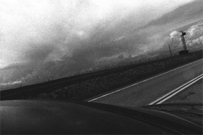
I started shooting them in about 2000. They are hard to find, and when you spot them, you are usually on a road driving 65 miles per hour, and it's very hard to turn around to get the right "portrait" of them. The image here is taken off the Blue Ridge Parkway, North Carolina in May 2005. If you click on it, it will blow up the text which reads: (and tells it all.. finally!)
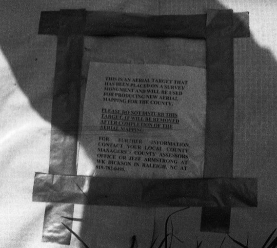
This is an aerial target that has been placed on a survey monument and will be used for producing new aerial mapping for the county. PLEASE DO NOT DISTURB THIS TARGET. IT WILL BE REMOVED AFTER COMPLETION OF THE AERIAL MAPPING. For further information, contact your local county managers / county assessors office of Jeff Armstrong at WK Dickson in Raleigh, NC at 919-782-0495.
All content is ©2020 by Cynthia Connolly